I have sometimes wished it was my destiny…

In the spirit of Looking Backward, pointing you to this letter featured on the Paleofuture blog, written by Benjamin Franklin to the Reverend John Lothrop of Boston, May 31, 1788.

An excerpt:

I have sometimes wished it had been my destiny to be born two or three centuries hence. For invention and improvement are prolific, and beget more of their kind. The present progress is rapid. Many of great importance, now unthought of, will before that period be procur’d; and then I might not only enjoy their advantages, but have my curiosity satisfy’d in knowing what they are to be.”

Isabella Stewart Gardner turns 173

Image

“Every year,” writes Patricia Vigderman, “on her birthday, April 14, a Mass is still said in the chapel she installed on the third floor of that palace. I attended the seventy-ninth performance of the ritual, where I sat beside a long wooden carving that unfurls the injunction to say only good of the dead. I heard the little bells, smelled the incense; around me were prayers responses, sunlight and quiet, the fountain splashing in the courtyard below. Se monumentum requires, circumspice, said the priest. He was referring to Christopher Wren and his St. Paul’s Cathedral in London, but also to the woman in whose house we were sitting. We have to thank her, he concluded cheerfully, for giving us something to talk about.”

The opening lines of The Memory Palace of Isabella Stewart Gardner Museum.

Preservation and affordability advocates call truce in JP

It’s an odd alliance at first glance. The Boston Preservation Alliance and Occupy JP have united to oppose demolishing the “Knight’s Children’s Center” on Huntington Ave. The Home for Little Wanderers is relocating to Walpole, and the latest plan for its site is to tear the buildings down and put up a high-end apartment building.

Here are the basics of the dispute from the Jamaica Plain Gazette:

Occupy JP calls for the space to be filled by owner-occupied triple-deckers, a homegrown remedy to poverty with a proven record,” the statement continued. “Spread the wealth or find the homeless, orphans, widows and others sleeping on your doorstep.”

Curtis Kemeny, whose Boston Residential Group is planning the high-end apartment building, previously told the Gazette that the existing buildings cannot be reused due to their age and the difficulty of reconfiguring them.

That includes a 1914 brick building at the core of the complex. Neiswander, a Jamaica Plain resident who said she was writing with the permission of the BPA’s board and executive director, noted that several other S. Huntington Avenue institutions have reused historic buildings. She noted that the 1914 building is “a sturdy brick building of human scale that should be eminently adapatable for residential use.”

It’s worth pointing out that the proponents of historic preservation and the proponents of affordable housing are not always natural allies. Often as not, for example, in the case of St. Aidan’s in Brookline, finally converted to affordable housing in 2010, housing advocates come up against preservationists and others who don’t want to see changes made.

Today, Tim Fernholz argues at GOOD that, “Local policies about land use and transit make America’s most productive places—our largest, wealthiest cities—prohibitively expensive for many people.”

The people already residing in those cities have enacted policies that have, in essence, built a wall around them. Limits on the size of buildings mean that fewer apartment units are built; demands that the needs of cars take precedence over the needs of people create vast parking lots that take up valuable land; zoning restrictions make it harder to create thriving neighborhoods with many types of housing and businesses. In his polemic, “The Rent Is Too Damn High,” Matt Yglesias notes while residents fight to preserve the character of iconic neighborhoods like Brooklyn’s Park Slope or Washington, D.C.’s Georgetown, those neighborhoods would be illegal to construct today.

Fernholz argues that high costs of living, combined with rising college debt, keep people from making the move to one of the country’s historically magnetic cities, like New York. Forget Georgetown. More dramatically, there’s the height restriction on all buildings in Washington DC, which gets a lot of blame for that city’s rising rents.

In the JP case (which, just to clarify, doesn’t involve affordable housing) the figurative keys to the bulldozers currently rest in the hands of the Boston Redevelopment Authority (BRA) after the Boston Landmarks Coalition (BLC) imposed a 90-day moratorium.

So, JP-ers, keep an eye on the alphabet soup and ponder this one awhile.
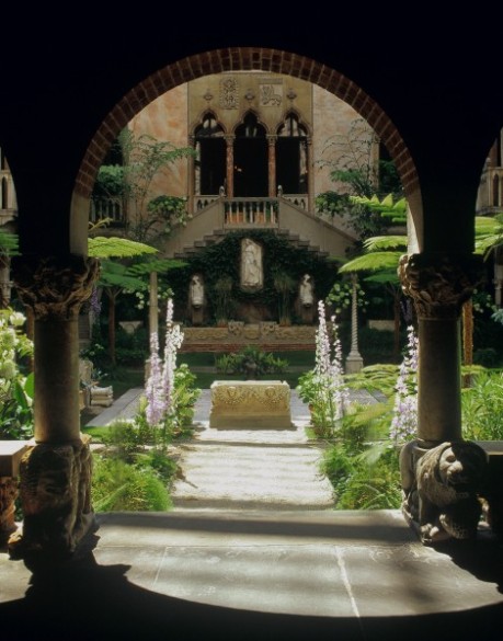
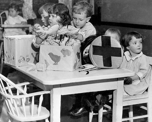
Photo shamelessly stolen from the Home for Little Wanderers’ incredible Flickr stream. If you like that one, check out the kids occupying this tree house on Halloween. The Thanksgiving turkey drive. Man, I could go on and on.

How Boston got its first airline route

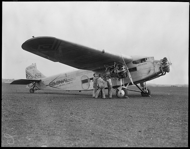
1929 photograph of Colonial Air Travel passenger plane, by Leslie JonesThe flight from Boston to New York would take one hour forty-five minutes.

It was the mid 1920s: a happening time between world wars. The United State Postal Service had successfully proved its experiment in putting excess planes to work ferrying mail from coast to coast, so that the government felt confident putting its airmail routes out to bid to private aviation companies.

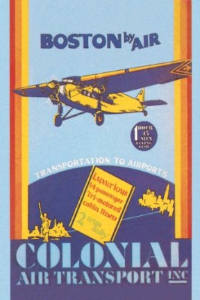
An unknown Charles Lindbergh  would fly mail between Chicago and St. Louis for one of those little firms. Meanwhile, another, Colonial Air Transport, launched in New York City by ex-air force pilo Juan Trippe, who later founded Pan Am, got its first contract in 1925. Colonial originally flew just a mail route between New York and Boston.

However, in 1927, the same year the small airline relocated its headquarters to Boston and Lindbergh captivated Americans with his flight across the Atlantic, Colonial began offering the first regular passenger service. Starting in April, Colonial’s planes, like the one in this photo by photographer Leslie Jones, flew steadily between Boston and New York.

Jones, a Boston Herald-Traveler photographer, took this particular photo in 1929 at the East Boston Airport.

Another company, AVCO purchased Colonial in 1930 and combined it into a network that eventually would become American Airlines.

Photo: Boston Public Library/via Flickr. You can peek inside the airline’s time tables here.

The first card catalog?

In 1812, William Croswell, an “early nineteenth century eccentric”  – otherwise known for writing little-read, obscure books about astronomy, creating a well-received map of the stars (the first American star-map), and incurring debts to friends – was hired by Harvard to produce a new printed catalog for the library.

The library contained about 20,000 books, and was arranged by donor of the volumes.

Croswell apparently didn’t get on well with students, who played pranks on him including hanging a skeleton in the library. But he slowly and steadily progressed, until he had a list. He then began the task of putting it in a more logical order. Eventually in May of 1817 Croswell began cutting the list into strips, a task which took six weeks. Then he was able to arrange the slips under the appropriate headings.

Croswell eventually got fired for taking too long to finish the catalog.

But in 1840, librarian Thaddeus William Harris wrote that the Harvard Library should compile a slip catalog, listing all the collection’s titles on pieces of paper.

Harvard College Librarian Thaddeus William Harris urges in his 1840 annual report that a “slip catalogue” be created consisting of the title of every work in the library on pieces of card 6 1/2 inches long and 1 1/2 inches wide.  Library historian Kenneth E. Carpenter (who put together a comprehensive history of the library in 1936 [PDF]) gives Croswell the credit.

Lists of a library’s inventory date back much farther, from writing on the walls to scrolls. Harvard at least claims their catalog is the first of its kind. The Encyclopedia of Library and Information Science says perhaps not and points back to Europe. The Harvard library was one of the first libraries to hire women, who hand-wrote many of the cards.

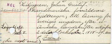
Photo via Library History Buff. HCL stamp in the lefthand corner stands for “Harvard College Library.”

The first home of Sylvia Plath

One of the disappointing realities of historical signage campaigns is the signs themselves just don’t have all that much impact unless you know what you’re looking for. We expect them as part of any normal historical preservation effort, but a discreet metal plaque on a wall with some dates – it’s sort of anti-climactic.The backstory’s usually better told in detail, told aloud.

At the same time, it’s a surprise to learn that the Sylvia Plath’s first residence doesn’t have a marker. No ‘Sylvia Plath lived, slept here.’ Nothing. The author of The Bell Jar and the book of poems, Ariel was born in a Boston hospital on October 27 of 1932.

Plath biographer Peter Steinberg commented below: “Sylvia Plath was born in Boston, at a building at the corner of Harrison Ave and Stoughton St (02118) at what is now the Boston Medical Center. The building where she was born was still standing a few years ago and presumably still is. Sylvia Plath was not born in JP, she just lived there. Plath’s brother Warren, however, was born at the Faulkner in JP.”

This blog is a not turning into a historic buildings blog in a here’s your obscure, picturesque Victorian of the day sense. Don’t worry.

But for now, more on that house: It’s on JP’s Prince Street. The home’s a fairly non-descript suburban stand-alone with a porch, near the Arnold Arboretum. A convenient walk for Plath’s father, a Boston University botanist who studied bees.

Plath’s family moved to Winthrop when Plath was four. As an article in the Jamaica Plain Gazette muses (this is the real fodder for your imagination):

Had she lived there longer perhaps her nautical poem “Point Shirley,” which poignantly details the coastal terrain of Winthrop, where the family moved, would instead be about the Arboretum or the historic Unitarian Church in JP center, where the family worshipped. Perhaps the seacoast iconography would have been replaced by images of the spartan Jamaica Plain Monument or the undulating terrain of Forest Hills Cemetery. [link added]

That would be different. See photos of all Plath’s homes throughout her life collected at Steinberg’s website sylviaplath.info. Thanks to him for the correction.

Thirsty horses and trolley cars

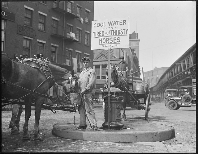
Photo of a downtown fountain for thirsty horses via Boston Public Library’s Flickr stream.
Would take one of these for people right about now.

The ASPCA, founded in 1866 spread to many American cities, and lobbied on behalf of draft horses.This scene was already on the wane in the 1920s. Horses were superseded by electric trolley lines through expanding cities (What’s that off in the background? A stretch of elevated railway). This mode of transport first proved commercially viable…in Boston. From “The decline of the urban horse in American cities“:

Henry Whitney, a Boston land speculator, and Charles Francis Adams, Jr (scion of the famous Adams family) built a trolley line to connect their suburban landholdings in Brookline with downtown Boston. Reports on the windfall profits that Whitney made on his property led to the rapid adoption of electric trolleys in other cities. The 1890 census estimated that trolley operation cost only $38,000 per mile, compared with $50,000 for horse cars.

As or more importantly, the automobile also made headway in cities after 1900. More from the same academic publication:

Between 1742, when horses were taxed for the first time, and 1841 there were roughly forty humans for each horse. By 1880 the ratio had dropped to twenty-five, although it was back up to forty in 1900 after the electrification of street railways…by 1920 Boston had fewer horses than in 1820.

Interestingly, Atlantic Ave, where this fountain for parched draft animals is set up has seen a lot of clearance and reconstruction. The streetscape looks nothing like this today. This 1922 photo is another by Leslie Jones, Herald-Traveler staff photographer.

The Blackstone Block

Photo via the Boston Public Library Flickr stream.

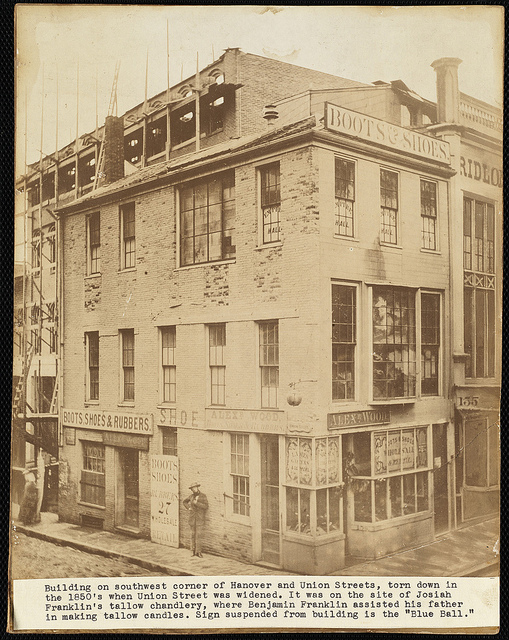
A narrow alley, only six feet wide: hardly the sort of careful, modern road we’d lay downtown today. Once more, we take you back to the environs of Quincy Market, where you can walk the last traces of the city’s original street grid.

The ‘Blackstone Block’ is the area sandwiched between Union, Hanover, North and Blackstone Streets. These are some of the city’s oldest routes. Sadly, the city was not laid out laid out along cowpaths. That’s a charming urban myth. The cramped layout owes more to “unscientific” planning and natural obstacles like hills and brooks. Blackstone Street actually lies on top of the old Mill Creek, which was crossed by drawbridges and, you guessed it, powered a mill.

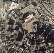
That’s the wide open City Hall Plaza in the center, and the Blackstone area in the bottom right.

Author/historian Walter Muir Whitehill once wrote that the Blackstone Block “represented a chronological history of buildings in Boston.” The 17th century streets and alleyways are lined with mostly 18th and 19th century buildings, all built within what was then spitting distance of harbor (land later expanded as real estate grew more valuable than the old docks). The original structures would have been made of wood.

The streets were once busy and noisily commercial. The neighborhood’s still home to the famed tourist trap, The Union Oyster House. The Blackstone Block’s restoration was carefully done to suggest just how cramped conditions originally were. Borders of brick and cobblestone outline the original streets and buildings (cobblestones = streets; brick = buildings).

In a classic mish-mash of good intentions, “Historic street lamps were found in a scrap metal yard, restored, and fitted with energy-saving lights.”

That Muir quote comes from a fascinating document from the urban renewal area on how the Blackstone Block should be handled and preserved from the wave of change that swept through the areas around this old pocket. The report is from 1964 and observes the block has many vacancies but the future “is very promising.”

Road trip: The original fast food chain

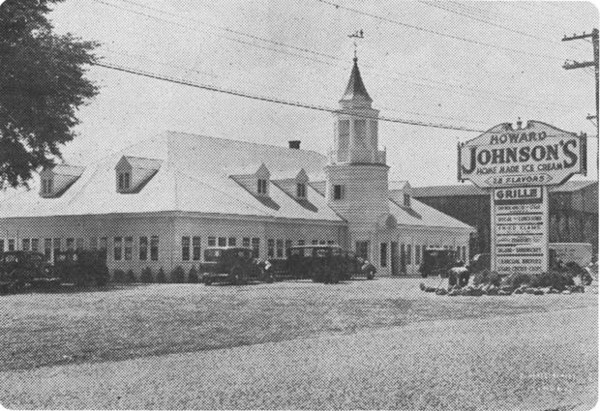
The Wakefield, MA Howard Johnson’s franchise opened June 14, 1936, at the head of Lake Quannapowitt. Photo via Digital Commonwealth.

This holiday weekend, at the side of the road, you’ll find one McDonalds after another, Boston favorite Dunkin Donuts, that newfangled McCafe, but back at the dawn of the interstate, the dependable, ubiquitous chain restaurant was Howard Johnson’s from Quincy. Fare: Frankforts, fried clam strips, and 26 flavors of ice cream.

In his new (and frankly, phenomenal) history of the country’s interstate highways, The Big Roads, Earl Swift says the original chain with a reputation for unvarying service was launched by Howard Deering Johnson, who bought out a beachfront drugstore in Quincy –

and enticed customers to its soda fountain by offering the richest ice cream in town, which he hand-churned with gobs of extra butterfat. He expanded the ice cream business to a stand on the seashore, adding flavors along the way, and eventually opened a bona fide restaurant in downtown Quincy. His twenty-eight flavors became a signature. His fried clams became a destination.

Johnson intended to open additional locations, but the Depression intervened, so instead a friend agreed in 1935 to share ownership in a second restaurant on Cape Cod, using the Howard Johnson’s name and menu. That was the first roadside HoJo’s, and both the business and the franchise arrangement were hits.

Thirty-nine had launched by year’s end. There were 107 by the end of 1939, and the chain’s “exclusive contract” with an early, ambitious, toll funded highway – The Pennsylvania Turnpike – made it a familiar roadside face.

Jayne M. D’Onofrio, who included the photo above of a franchise in a Wakefield Municipal Gas & Light Department calendar, describes tremendous buzz on opening day. Traffic jams occupied five Wakefield policemen. “When the restaurant closed at 10 p.m. that evening, more than 900 chicken dinners, 1,150 gallons of ice cream, and 4,500 frankfurters (their specialty) were served throughout the 11 hours.”

A last note on Big Roads: Otherwise Swift spends relatively little time in the Boston region and the Northeast. The Central Artery and Big Dig get a passing mention as a late effort by a city to come to term with its freeway through downtown.

Tadeusz Kosciuszko, hero of two continents

Tadeusz Kosciuszko:

Polish national hero – check.

Lithuanian national hero – check.

Belarussian – check.

And American – that too.

Kosciuszko was one of many of the European continent (see: Lafayette) in the Continental Army, serving under Generals Gates and Washington in the Revolutionary War. Afterwards, he was rewarded with: a promotion to Brigadier General, American citizenship, and a plot of land in Ohio.

An abolitionist, he left his property to be administered by Thomas Jefferson when he returned to Europe – to be used to buy the freedom of slaves and pay for their educations (Jefferson abdicated his assignment after Kosciuszko’s death).

But, as noted, before Kosciuszko died, the Revolutionary war hero returned to Europe, signed up with the Polish military, and made his reputation on the Continent.

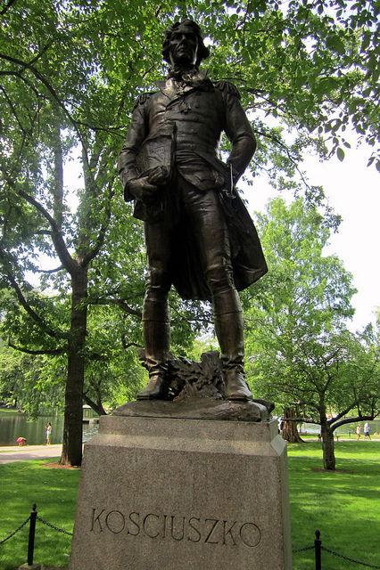
Though he doesn’t seem to have made much of his own history in Boston, his tenuous connection to the city is this statue on the Boston Commons that was put up by the city’s Polish Community in 1927 (that’s 150 years since he joined the Continental Army). The female artist was Bostonian, Theo Alice Ruggles Kitson (who deserves her own post). He’s also the subject of memorials in Detroit, Milwaukee, Chicago, Washington DC, St. Petersburg.


An interview with his biographer.

Photo of the Boston Common statue by apparent Boston statue connoisseur, Wally Gobetz. One favorite that he’s documented, frankly too recent for this blog, is the Tortoise vs. Hare race of Copley Square, installed 1994.